Ostrava Maps and Orientation
(Ostrava, North Moravia, Czech Republic)
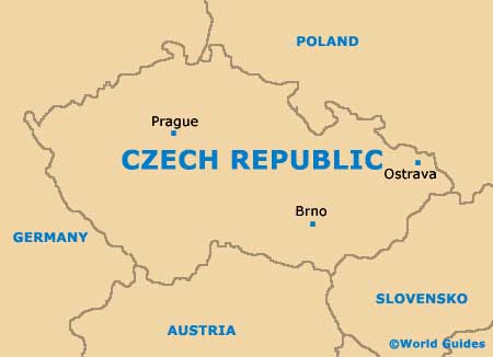
Standing on the north easterly side of the Czech Republic and within the Moravian Silesian area, the city of Ostrava enjoys an especially important location, being situated at the very point where the rivers of the Oder, the Ostravice and the Opava meet. Ostrava is especially close to the borders to both
Poland and also Slovakia, both of which are just a short drive away.
The Czech city of Ostrava enjoys a particularly scenic location, on the northerly side of the valley known as the Moravian Gate. This position means that the scenery surrounding the city is extremely beautiful and well worth exploring.
Maps and Orientation of the City
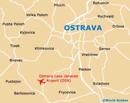
Ostrava is home to just over 300,000 residents and contains approximately 20 different districts, which are the direct result of the city's expansion, swallowing up neighbouring towns and villages as its boundaries extended. The Old Town area of Ostrava is chock full of history and where you will encounter many historical buildings, particularly along the easterly Ostruzinická.
The main railway station is situated further east and across the Moriva River, near to the bus station. A map of Ostrava is always useful and maps can be found at bookshops along the Ostruzinická, and also at the main tourist information office, within the town hall. Maps are also available at the tourist outlet within Ostrava's train station, where you can also purchase the handy Olomouc Card.
- Bohumin - 12 km / 7 miles (15 minutes, north)
- Brno - 181 km / 112 miles (two hours and 25 minutes, south-west)
- Havirov - 17 km / 11 miles (22 minutes, south-east)
- Mistek - 22 km / 14 miles (30 minutes, south)
- Odry - 49 km / 30 miles (55 minutes, south-west)
- Olomouc - 102 km / 63 miles (one hour and 45 minutes, south-west)
- Opava - 34 km / 21 miles (45 minutes, north-west)
- Orlová - 14 km / 9 miles (20 minutes, east)
- Prague (Praha) - 383 km / 238 miles (four hours and 45 minutes, west)
- Sumperk - 125 km / 78 miles (two hours and ten minutes, west)
- Vyskov - 144 km / 89 miles (two hours and five minutes, south-west)
- Zábreh - 20 km / 12 miles (25 minutes, west)
- Zlin - 105 km / 65 miles (two hours, south-west)
Map of the Czech Republic
Map of Ostrava